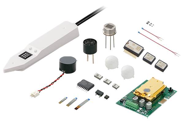
Sensors

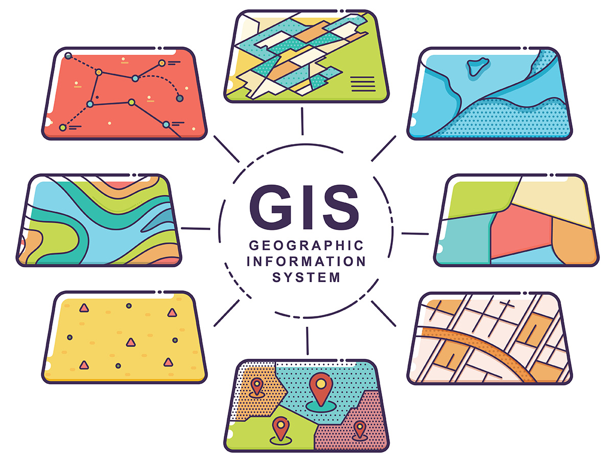
GIS stands for “geographic information system,” a system that displays various information on maps for different purposes. Information about events associated with the positional information of a given point or area in space is known as “geospatial information.” For example, population distribution, land values, building attributes, inundation levels during floods, and other information about a given area or point can be color-coded for different purposes. Dynamic information such as the flow of people and goods and meteorological changes can be visualized. Different types of geospatial information can be overlaid. These actions and more make it possible to visualize multiple types of information simultaneously so that the desired information can be understood visually, expediting and enhancing the sophistication of analysis and decision-making.
GIS can be used for a wide range of purposes, including city planning, hazard maps for disasters, disaster prevention planning, and monitoring infrastructure as well as evaluating accessibility to everything from real property to train stations and analyzing trade areas, which is key for planning new commercial facilities.
GIS services in everyday life include car navigation systems and smartphone map applications that add building information, traffic conditions, and other geospatial information to points and areas on GPS-based maps.
Originally, the vast majority of GIS offered 2D displays, but with the advancement of technology, many systems now feature 3D displays capable of visualizing geospatial information more clearly for different purposes. Now, 3D display services are readily available, for example in smartphone map applications.
However, 3D displays in typical services are geometric models with 3D polygons comprising geometric representations (triangles or polygons) of the state of the ground surface—the displays do not distinguish between topographical features, buildings, adjacent buildings, streets, and other objects. Therefore, it is difficult to link positional information with 3D data and detailed geospatial information with meaningful precision.
For example, it takes an immense amount of time and money to create the precise, detailed 3D data to underpin advanced applications such as detailed analysis and simulation for city planning and disaster risk reduction planning, and to create digital twins of cities, which are essential for achieving smart cities. Amid these circumstances, the need for open, highly precise 3D city models has increased, prompting many countries to develop and utilize data.
A common platform is essential for enabling national and local governments as well as corporations and individuals to utilize 3D data for a wide variety of purposes. In response, Japan adopted CityGML—the international standard established by the Open Geospatial Consortium (OGC), an international standardization organization in the field of geospatial information—making it possible to utilize the data from its 3D city models in a broad range of applications in Japan and around the world.
Additionally, CityGML deploys not only a conventional geometric model comprising uniform geometric shapes, but also a semantic model that classifies, defines, and assigns height and attribute information to each building and street. This makes CityGML compatible with advanced applications that require high precision and sophistication.
Plateau is a CityGML-compatible, open 3D city model created by the Japanese Ministry of Land, Infrastructure, Transport and Tourism with the aim of realizing the Society 5.0 concept. Although Plateau was launched later than other countries’ CityGML-compatible models, it is now the world’s most extensive open 3D city model, covering 56 cities, an area of 10,000 km², and 10 million buildings across Japan* with ongoing updates and expanded use cases.
* According to an August 2022 press release by the Japanese Ministry of Land, Infrastructure, Transport and Tourism
Plateau mainly comprises three types of data.
The first is data collected via the main means of creating conventional 2D data: aircraft. Specifically, this refers to height data from aerial surveying with laser profilers and image data from aerial photography. The second type of data is basic city planning maps: 2D map data provided by local and municipal governments. The third type is rich data: attributes, structures, specifications, classifications, ages, and other properties of individual buildings from legally mandated basic city planning surveys, which in the past were mainly used locally.
This excavation and repurposing of valid data from past surveys into a new format—3D city models—is believed to represent significant savings compared to the staggering cost of building the models from scratch.
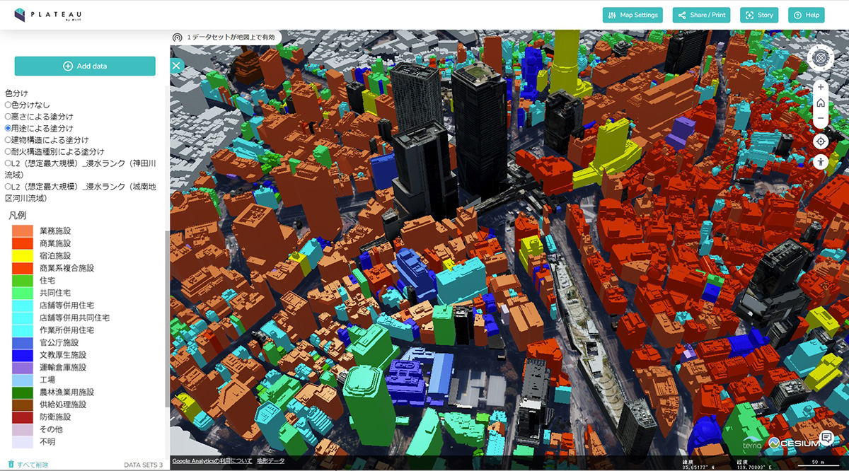
Notably, Plateau offers downloadable open data compatible with a range of 3D graphics software in addition to Plateau View, an online application that allows users to view 3D models and associated data for any area or point (Figure 1).
The open data of Japan’s CityGML-compatible 3D city model, Plateau, works with many applications and can also be used commercially, making it useful to national and local governments as well as companies and individual creators for a wide range of purposes in all industries.
Another major advantage is that Plateau provides 3D models linked to coordinates with a high degree of precision in addition to building textures and the corresponding attribute information, which is useful for many different purposes. The highly precise linkage to coordinates makes it possible to accurately assign the desired data to 3D models of the desired area or location. Thus, Plateau enables more advanced simulations and city planning, and can also be used to create digital twins that interlink cyberspace and the real world. It can also be used in entertainment and communication, for example to create precise 3D model-based backgrounds for video games or high-resolution virtual reality (VR) and augmented reality (AR).
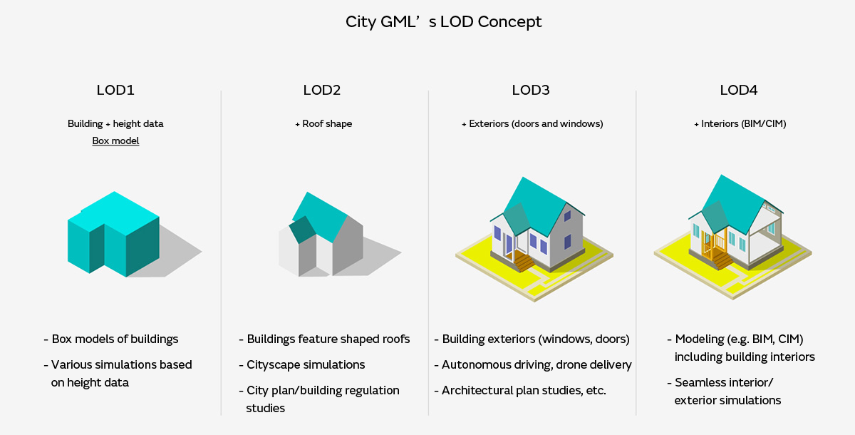
Notably, CityGML facilitates centralized management of the detail of 3D objects based on the Level of Detail (LOD) concept. The system presently comprises up to four LOD, from LOD1, which renders buildings as cube-shaped objects, to LOD4, which illustrates building exteriors in intricate detail in addition to linking to 3D data of interiors (Figure 2). Changing the scale of conventional 3D objects is cumbersome, but CityGML makes it possible to centrally and efficiently manage, store, and utilize data for individual objects with multiple levels of detail. This enables seamless 3D displays of everything from bird’s-eye views of cities to close-up views of buildings and building interiors; the possibilities include creating digital twins of commercial facilities, allowing users to make real-world purchases from virtual stores in cyberspace.
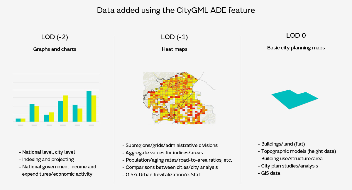
CityGML also has a feature called Application Domain Extension (ADE) that extends the definitions of planimetric features and attributes, allowing the data to be added for different purposes (Figure 3). Additionally, data extended using the ADE format can be reused and repurposed.
This section presents example applications of 3D city models in the CityGML format for different purposes, based on Plateau use cases.
To this point, we have focused on example applications for digital transformations that affect cities and people. That said, electronic equipment is essential for monitoring cities to collect data, automating operations, and communicating the necessary data for these activities. Simulations and data from 3D city models can be used to study the efficient deployment of electronic equipment.
For example, we cannot install an unlimited number of sensors and cameras to monitor how people move around. Instead, we use 3D city data to conduct simulations to consider sensor and camera placement plans and use the results to streamline sensing and data collection with a limited number of units.
3D city model-based analysis and simulations can also be used to plan the placement of the base stations needed for wireless communications. 3D city models are also expected to be used in flight simulations for delivery drones, which are expected to become more widespread in the near future. If safe flight paths can be selected from 3D city models with height data for individual buildings, there will be no need to expend as much time on field surveys.
As demonstrated, CityGML-compatible 3D city models should be useful not only in policy development, planning, and services, but also in many other applications such as considering the required specifications and methods of operating hardware and devices. 3D city models are a major step toward popularizing and expanding the use of digital twins, and as use cases increase, the open data will grow richer and be more available for people in all industries and positions to apply their new ideas.