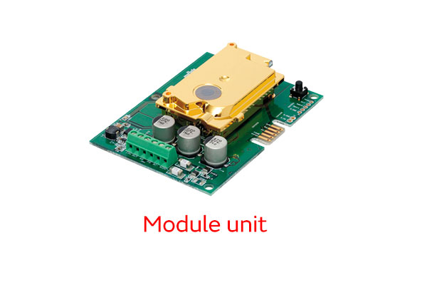
Soil sensor
The temperature and the sea level are rising due to climate change. That is causing droughts to increase. On the other hand, damage from heavy rains is also increasing. These problems have various negative impacts on oceans and land around the world. Above all, the negative impact on the soil is damaging agriculture in that it stops becoming possible to grow plants. This is a blow to the stable supply of food. It is also necessary to take measures as soon as possible on the adversely affected soil to realize sustainable agriculture.
The tsunami resulting from the Great East Japan Earthquake in 2011 caused extensive damage to agricultural land in Japan. There were concerns about salt damage to crops due to seawater intrusion. Therefore, desalination work on the affected agricultural land was carried out over a wide area as part of the project to recover from the disaster. A demonstration test was also conducted to observe the salinity utilizing soil sensors on agricultural land after desalination. What is the potential for sensing technologies to contribute to agriculture? We spoke with Hitoshi Kanno, a former associate professor at the Graduate School of Tohoku University, about an overview of the desalination work and the use of sensing technologies in smart agriculture.
-- Salt damage is said to cause serious damage to agriculture. How important is soil to agriculture?
There are soils that are suitable for crop production and those that are not. Although we simply say "suitable for crop production," there are various factors to consider. In terms of physical aspects, for example, it is important that the soil drains well and that there are no problems with the root growth . Moreover, it is important to be able to properly supply the nourishing water required by produce in terms of chemical aspects. Furthermore, importance is attached to diversity of microbes and living things in avoiding unbalanced properties so that only specific pathogens reproduce in terms of biological aspects.
In fact, it is not simple to be able to categorize soil like that. The properties of soil suitable for agriculture change depends on the purpose.
-- Please tell us what kind of research you are conducting specifically in your specialty of soil science.
Soil science is a discipline that promotes research from the aspects of how soil is formed, what it is comprised of, what characteristics it has, and how to use it. Among those issues, my area of expertise is soil fertilizer science. I have mainly conducted research on how plant growth and nutrient absorption changes through the interaction between soil and crops.
-- Climate change is spreading around the world due to the impact of global warming. Against this backdrop, what kind of issues are there in terms of soil science?
Water damage caused by heavy rain and other elements is often associated with global warming in Japan. On the other hand, there are also regions in the world concerned about a decrease in rainfall due to the impact of climate change. Salt accumulation in the soil and salt damage to crops have become problems in these regions.
-- Why does salt damage occur when there is little rain?
In humid areas - where rain falls throughout the year, the amount of rainwater is greater than the amount of water that evaporates from the surface of the ground. This means that salt is less likely to remain in the soil. However, in semi-arid areas, the amount of underground water that rises up and then evaporates from the surface of the ground is greater than the amount of rainwater. As a result, the salt contained in the underground water comes to a halt near the surface of the ground (salt accumulation) and that becomes the cause of salt damage to crops. Inadequate irrigation may also cause salt accumulation in agricultural land.
-- When salt damage occurs, the properties of the soil change. That also affects the growth of agricultural produce.
The main effects of salt damage on agricultural produce are that moisture absorption by agricultural produce is inhibited and that the nutrient balance is greatly disrupted due to the impact of the salinity accumulated in the soil. Therefore, crops stop being able to properly absorb the nourishing water they need.
The physical and biological properties of the soil may also be affected. Accordingly, if salt accumulates, the soil becomes unsuitable for crop production.
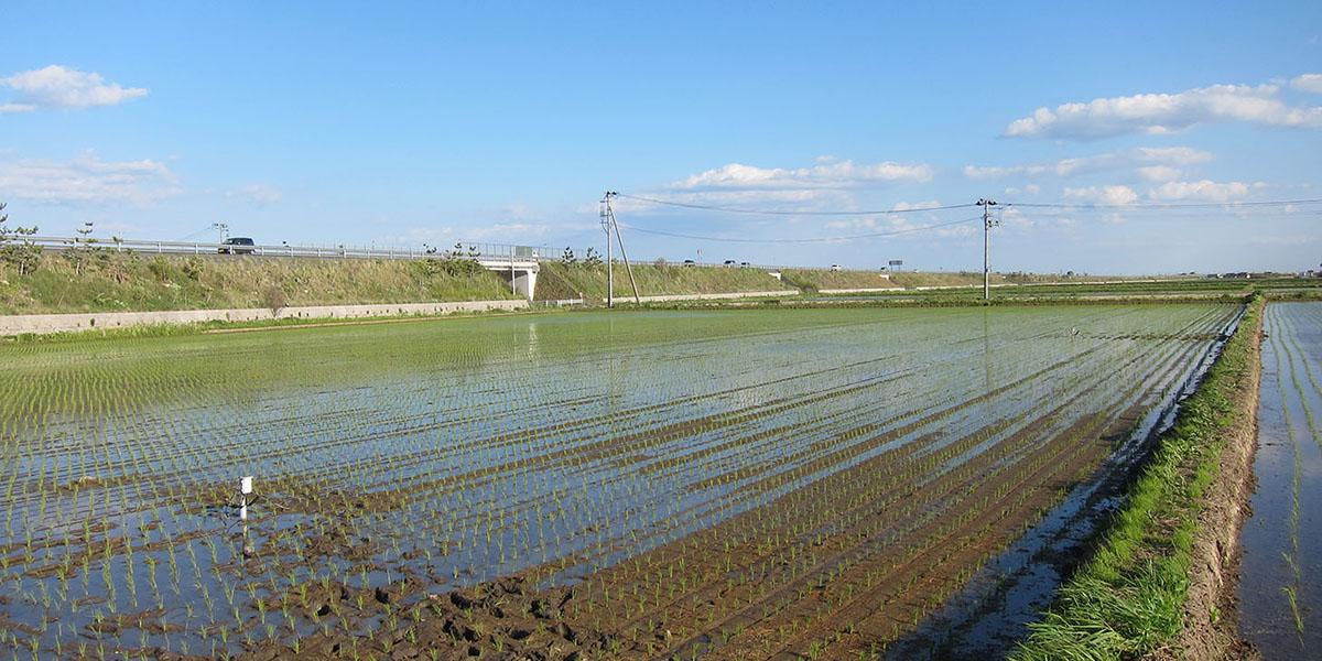
-- The agricultural land mainly along the coast of the Pacific Ocean in the Tohoku region was severely damaged by the tsunami resulting from the Great East Japan Earthquake in 2011. In addition to the damage caused by the destruction of irrigation and drainage facilities, the influx of foreign debris such as rubble, and soil runoff, there were strong concerns impacting crop production due to seawater intrusion (salt damage) (Photo 1).
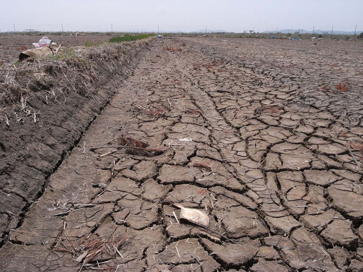
That was an extremely rare case in Japan of seawater intrusion damage over a wide area. The salinity of the soil then temporarily rose. It was not possible to grow agricultural produce in that state. Therefore, large-scale desalination work was carried out through a project to recover from the disaster to allow fresh water to permeate and wash away the salt underground.
The basic procedure with paddy fields was to repeat the work of waiting until the water level dropped a few days after filling it with fresh water and then measuring the salinity of the soil before adding more fresh water if the salinity was still too high. Through this procedure, the salinity of the soil was lowered to a level (standard value) at which there is no problem with crop production.
The desalinization work was mainly carried out over three years from 2011 through a project to recover from the disaster. It was carried out with a focus on inland regions with seawater intrusion in the first year. It was then carried out centered on the regions that were severely damaged by the tsunami on the coast in the second and third years. Finally, desalinization was completed in almost 99% of the regions targeted for recovery from the disaster.
-- Soil sensors were used to measure the salinity over time in the agricultural land after desalination, weren't they?
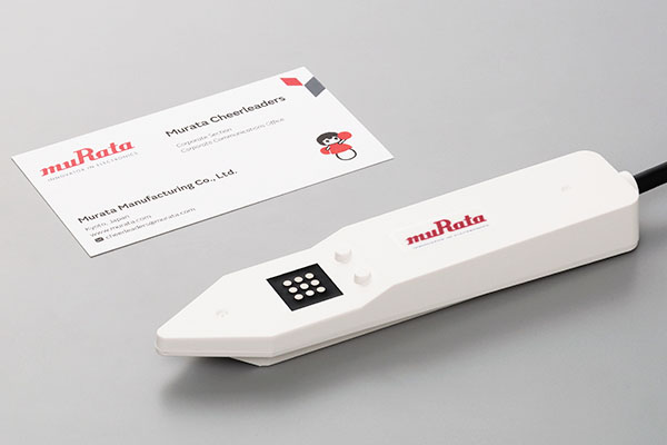
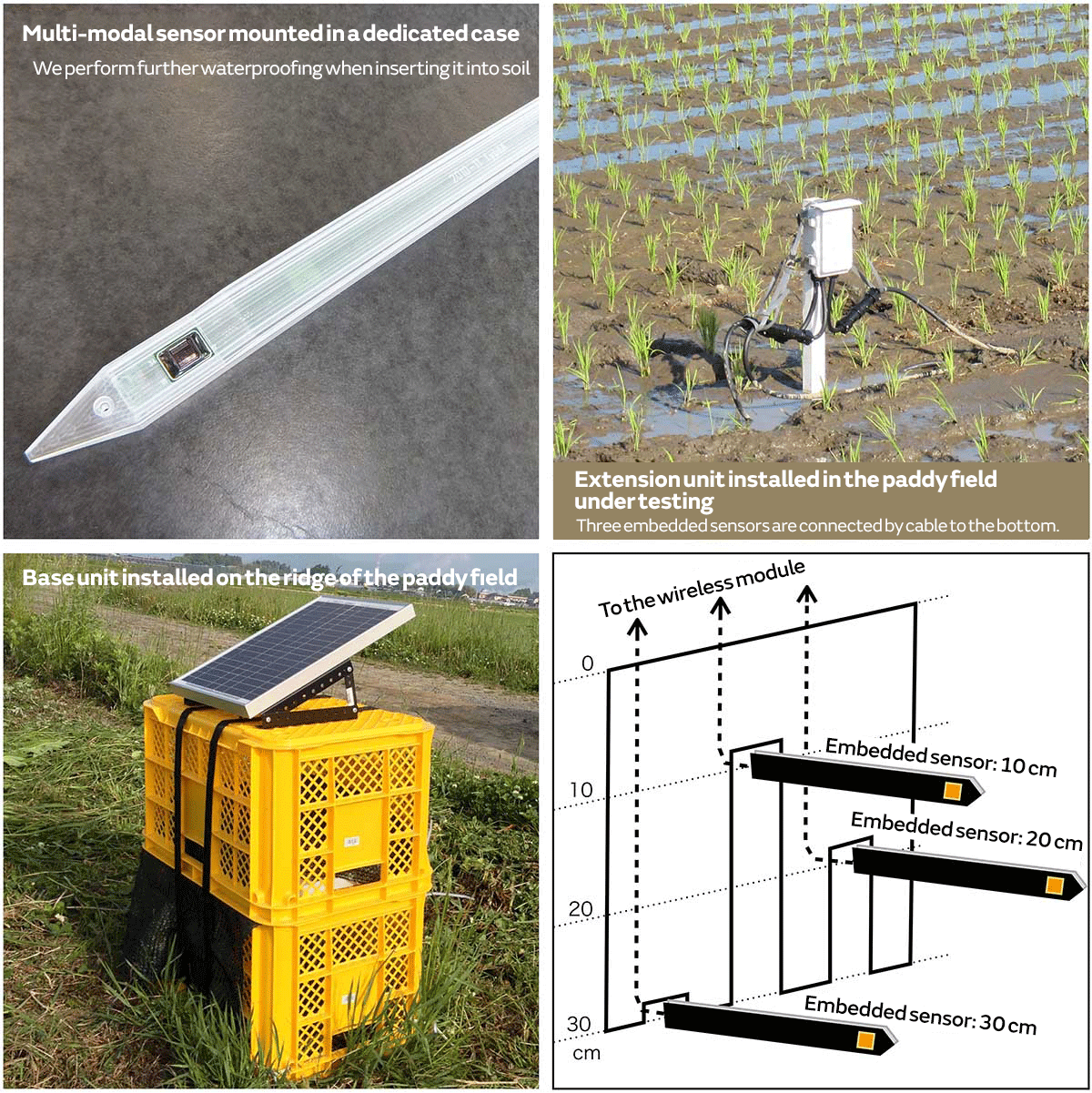
Tohoku University and Murata Manufacturing jointly conducted the Demonstration Experiment on Multi-modal Sensors in Agricultural Land Affected by the Tsunami in 2013 two years after the earthquake. In this experiment, we asked farmers in three disaster-affected locations in Miyagi Prefecture to carry out monitoring by inserting soil sensors into some of their paddy fields where desalination work had been completed. The soil sensors were embedded at depths of 10 cm, 20 cm, and 30 cm, respectively, at multiple points in one paddy field after rice planting. We then conducted the demonstration experiment on the wireless environment monitoring system that continued to collect data via wireless communications over the cultivation period.
The soil sensors we used in the demonstration experiment are capable of simultaneously monitoring the ground temperature and the EC*1. They are a multi-modal type*2 of soil sensor. The greater the amount of salt in the soil, the easier for electricity to flow. Taking advantage of that knowledge, we used the EC values we measured as an indicator of the salinity of the soil and then observed the changes in that.
*1: This refers to electrical conductivity. It indicates the ease at which electricity flows. The unit is S/m (siemens per meter). The current that flows also changes due to changes in the ion concentration contained in the soil moisture. It thus becomes an indicator of the salinity.
*2: This system makes it possible to simultaneously process various data. Multi-modal sensors with temperature sensor and EC sensor functions were used in this demonstration experiment.
-- Please tell us specifically how you measured changes in the salinity using soil sensors in the demonstration experiment.
Initially, the ground temperature and EC value data measured by the soil sensors every 30 minutes were sent via wireless communications to the base unit of the wireless environmental monitoring system we installed beside the paddy fields and then stored on a memory card. We went to the paddy fields to collect the memory cards once every two weeks. We imported the data onto a PC and then observed the changes in the numerical values. Moreover, when collecting the memory cards, we measured the soil EC values with a conventional method using soil samples at each depth, which we collected by inserted boring sticks around where the soil sensors were embedded. We also made a comparison at the same time with the EC values from the soil sensors (Photo 2).
-- What kind of sensor utilization possibilities did you discover through this demonstration experiment?
We can obtain various data simultaneously and continuously at multiple points with measurement by soil sensors using the wireless environmental monitoring system. That also enables analysis of the environmental factors behind the fluctuations in addition to changes in the salinity at each location and depth. I believe, for example, that it will become possible to precisely observe salt damage risks due to the impact and other effects of changes in the weather and farm work processes such as after it has rained or when draining a paddy field in preparation for harvesting. Fortunately, we did not observe any problematic rise in salinity during the cultivation period in any of the paddy fields that we used in this demonstration experiment.
-- What are your thoughts on the importance of sensing technologies in smart agriculture of the future?
Being able to obtain data continuously every 30 minutes in the demonstration experiment in 2013 was a new experience for me. The conventional method of measuring the soil EC value was to measure the EC value of the water suspension in the soil sample we collected. We had to go to the measurement site each time to collect the sample. The measurement frequency was once a week or month. It was impossible to continuously measure the soil without sensors. In other words, using sensors makes it easy to obtain big data relating to agriculture. I think that this will be extremely important for smart agriculture in the future.
Nevertheless, the method of measuring the EC value using soil sensors is, in fact, slightly different from the method of measuring the soil EC value used when we measure salinity in the field of agriculture. Normally, we measure the EC value (soil EC value) of the water suspension, which is a mixture of water and soil, and then use it as a guideline for the salinity of the soil. However, the EC value of the soil sensors is derived from a complex function of the pore water salinity and various soil characteristics. Accordingly, the relationship between the soil EC value and the EC value obtained from a soil sensor may vary depending on the type of soil and differences in the water condition. Therefore, I think the challenge is to understand in detail the relationship between the two.
-- How will such a gap in the data relationship be filled in the future?
We will need in future research to connect the vast amount of data relating to soil measured in the past to data newly measured with sensors. The Demonstration Experiment on Analysis of Factors Affecting Salt Tolerance of Soil Surface Rooting Rice will be conducted from June 2022 to March 2023. I have heard that new data linked to past data will be accumulated by using the new evolved soil sensors developed jointly by Tohoku University and Murata Manufacturing.
-- Solving challenges one by one will also lead to the realization of digital transformation (DX) and smart agriculture in the field of agriculture as well as other developments.
Soil does not change rapidly. Therefore, analysis of soil does not often require real-time data collection to that extent. Nevertheless, a variety of data (temperature, moisture condition, solar radiation, wind direction, and amount and content of fertilizer) are needed in research on models of growth for agricultural produce in terms of what differences emerge in the yield (amount of agricultural produce harvested). Yield production models have long been built by using the average values of the air temperature, soil temperature, and moisture condition over a certain period of time.
The utilization of values observed through the environmental monitoring system using soil sensors and other technologies will greatly contribute to such research. If it becomes possible to obtain a lot of data in real time by utilizing various sensors, we will be able to make even more highly accurate yield predictions. It will also become possible to think of measures to correct past models of growth, and I believe that this will advance our research.

Hitoshi Kanno
Former associate professor at the Graduate School of Tohoku University. Hitoshi's specialty is soil science: understanding the interaction between soil and plants, elucidating the characteristics and formation of soil affected by volcanic ash, and other areas. Born in Miyagi Prefecture in 1968. Graduated from the Faculty of Agriculture at Tohoku University. After leaving partway through a master's course at graduate school, he become a member of academic staff, assistant, and then assistant professor at Tohoku University before becoming an associate professor in April 2017 (field of soil location studies). Retired early from the university at the end of March in 2022. Currently undergoing an apprenticeship in his family business of agriculture. His publications include Inorganic Constituents in Soil: Basics and Visuals (co-author) (Springer Singapore), Secrets of Soil: Food, the Environment and Life (contributing authorship) (Asakura Publishing Co., Ltd.), Latest Agricultural Techniques – Soil Fertilization Vol. 4: Facing the Challenge of Agricultural Land Contamination from the Great East Japan Earthquake (contributing authorship) (Rural Culture Association Japan), and New Edition: How to Teach Soil (contributing authorship) (Kokon Shoin).